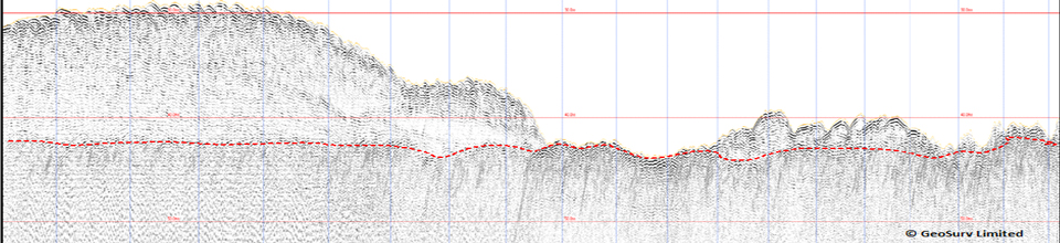


GeoSurv conducted a sub-bottom profiler data processing and interpretation exercise for a third party tidal developer for a site off the English south coast. A final report and charts were produced with an assessment of the data quality provided and recommendations for future work.
Archive for the ‘Uncategorized’ Category
Marine Current Turbines (MCT)
GeoSurv was contacted by Marine Current Turbines in December 2013 to conduct an assessment of data suitability gathered over a number of years for MCT by third party contractors. Various GIS and geophysical software applications were employed in order to critically asses the data and deliver a report outlining recommendations.
Fugro Survey Ltd.
GeoSurv was contracted as a Team Leader within the Geoscience Department overseeing the deliverables (reports and charts) for a number of TOTAL Ltd. Projects within the North Sea.
Offshore Marine Management
GeoSurv Limited have been providing an on going service to OMM since September 2012. Projects include conducting and overseeing a beach topographic and diver wade survey in Anglesey and data analysis/ report writing on the Forewind, Dogger Bank wind farm development.
Marine Current Turbines
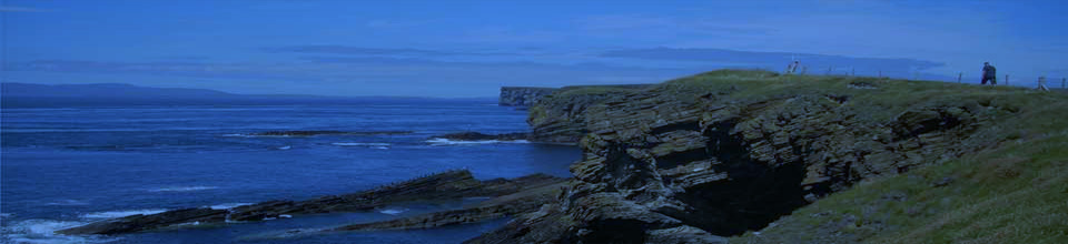
GeoSurv Limited was asked to conduct a desktop study of geophysical data for Marine Current Turbines (MCT) site within the Skerries, Anglesey. The objective was to determine further survey requirements for a cable route and also to map geological features within the bedrock particularly around the proposed turbine locations.
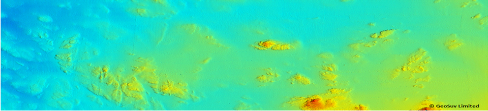
Arbroath Harbour Survey
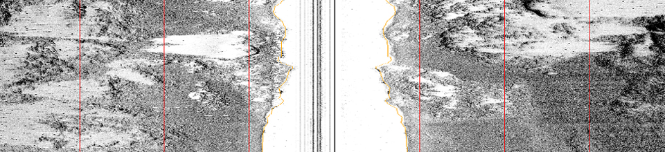
GeoSurv in collaboration with SOi Limited conducted a Swath bathymetry survey of the harbour and entrance channel at Arbroath, utilising a SEAswath system (468kHz) and a Trimble R6 RTK VRS positioning system. The survey was completed using the Zego 2 man quiet water survey craft.
GeoSurv Have Moved!
We are delighted to announce the move to new premises within Edinburgh City. Following on from the award of new contracts it was deemed necessary to move into a larger office space where processing and reporting could be undertaken in more comfort! Beaverhall House provides the type of accommodation suitable to GeoSurv’s current size and future plans.
Jersey Sea Defences
GeoSurv Limited are delighted to announce the award of a geophysical survey by the State of Jersey. The survey involves utilising a Geoswath Plus bathymetric system and Pinger sub-bottom profiler to investigate the seabed within St Aubin Bay and La Greve D’Azette as part of Jersey’s sea defence program. The program also includes grab samples and oceanographic measurements.
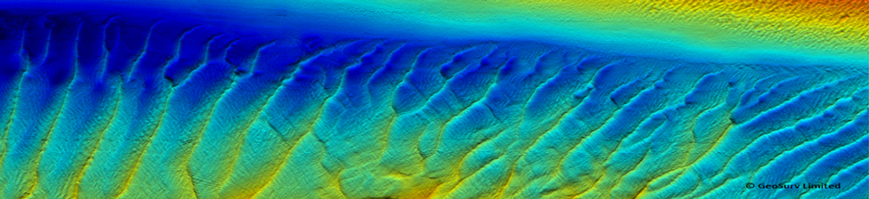
Geoswath Survey Montrose Bay
GeoSurv were delighted to be contracted by SOi Limited to undertake a bathymetric and backscatter survey of Montrose Bay for Angus Council. Utilising the Geoacoustics Geoswath Plus interferometric system and RTK positioning from a Trimble R6 VRS receiver proved a real success in this shallow water environment. The survey was conducted in late march and initially the weather proved challenging! The survey was contracted to Geosurv as part of the ongoing coastal erosion study of Montrose Bay. The survey included Montrose harbour and approach channel. The shallow draft and manoeuvrability of the vessel Swordsman meant the survey team were able to gather data in water depths of 1m which proved invaluable around the rocky coastline of Scurdie Ness and the large sand feature of ’Annat Bank’.
Pelamis Wave Power
Pelamis Wave Power in conjunction with Marine Scotland contracted GeoSurv Limited and our partner Scottish Oceans Institute (SOi Ltd.) to provide a sub-bottom profiling capability for soil investigations off Shetland. The joint venture utilised Marine Scotland’s research vessel the Alba Na Mara which was due to conduct drop down video along the north coast of the Scottish mainland and the southwest coast of Shetland. GeoSurv provided a sub-tow boomer and a pole mounted four transducer pinger array together with positioning equipment and personnel to operate the systems. After successful mobilisation and testing in Fraserburgh, poor weather resulted in the vessel heading to the north coast where drop down video work was conducted. Unfortunately the weather continued to be extremely poor resulting in the vessel unable to reach Shetland within the designated fourteen day survey window. Although disappointing the survey team and vessel worked well together and a number of important tests and procedures for working in the future fine tuned. GeoSurv would like to thank Marine Scotland and Pelamis Wave Power for their helpful and pro-active approach during this project.

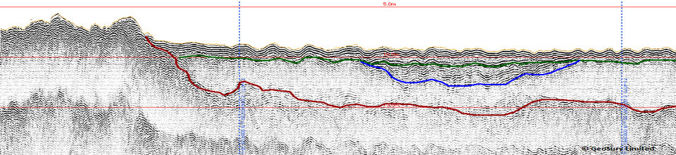
3.5kHz Pinger data gathered during wet testing in Fraserburgh Bay